Obama could still force Merrick Garland onto court during ‘intersession recess’
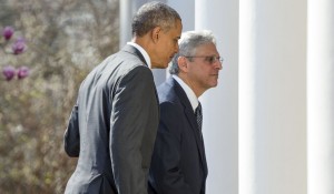
Lame duck president Obama and Merrick Garland, who he is trying to sneak on the Supreme Court before he leaves office. (AP photo)
Changes in the weather coming soon
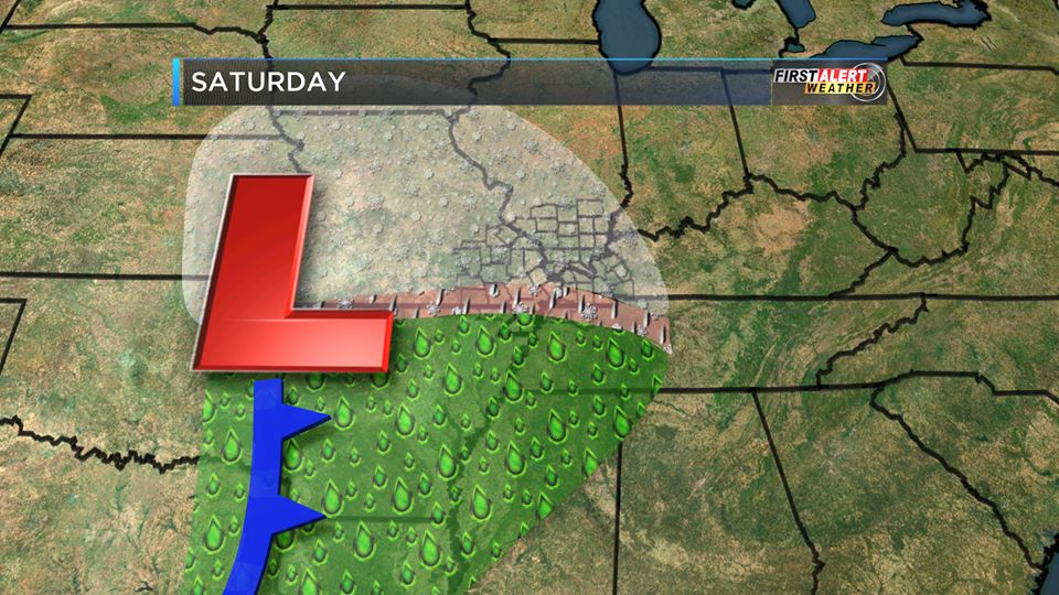
Ten o’clock weather update
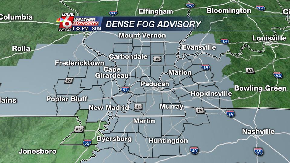
Here is the latest hazardous weather outlook from the National Weather Service:
.DAY ONE…TODAY AND TONIGHT AREAS OF DRIZZLE AND DENSE FOG ARE FORECAST TO SPREAD NORTHWARD ACROSS THE AREA TONIGHT AND CONTINUE THROUGH MID MORNING MONDAY. THE FOG WILL REDUCE VISIBILITIES TO LESS THAN ONE QUARTER MILE IN AREAS. PLEASE REFER TO THE DENSE FOG ADVISORY FOR MORE DETAILS. .DAYS TWO THROUGH SEVEN…MONDAY THROUGH SATURDAY A CHANCE OF THUNDERSTORMS IS FORECAST…MAINLY MONDAY INTO MONDAY EVENING. AN ISOLATED STRONG OR SEVERE STORM CANNOT BE RULED OUT. DAMAGING WIND GUSTS AND LOCALLY HEAVY RAIN WILL BE THE PRIMARY THUNDERSTORM HAZARDS.
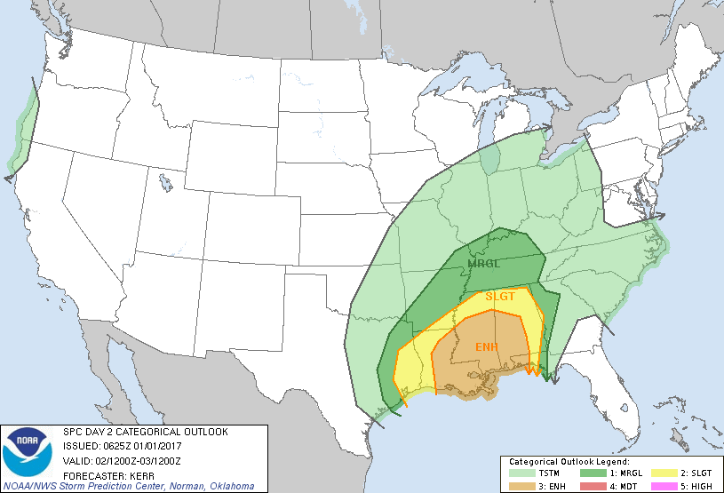
The Storm Perdiction center’s latest update shows a mariginal risk for severe weather from about I 24 south.
There is a slight chance of snow showers on Thursday. Models are all over the place on this.
The website will always keep you informed of severe weather events in real time if possible.
sd
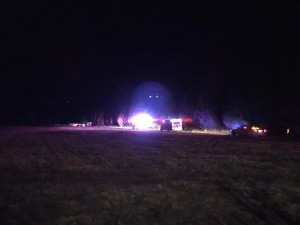
BREAKING: 4 dead in Johnson County plane crash
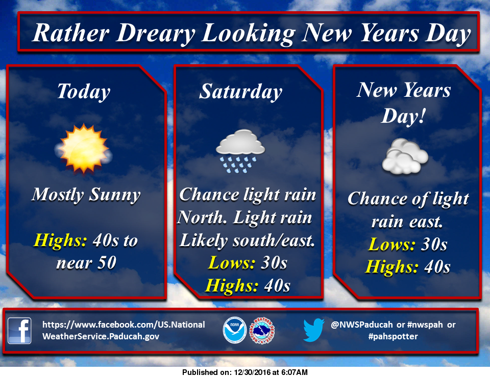
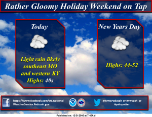
New years day forecast
Happy New Year!!!!!!!!

Other than the forecast, I will not post anything unless it is pertinent information for the residents of Franklin County. Be safe tonight. Please do not drink and drive. I wish you all a prosperous new year in 2017.-sd
A hodgepodge forecast to start the new year
Putin says Russia won’t oust U.S. diplomats in hacking flap
MOSCOW (AP) — President Vladimir Putin has condemned a new round of U.S. sanctions against Russia but said Moscow will not retaliate by expelling American diplomats. U.S. President Barack Obama on Thursday imposed sanctions on Russian officials and intelligence services in retaliation for Russia’s interference in the U.S. presidential election by hacking American political sites and email accounts. 35 Russian diplomats were ordered to leave the U.S.in 72 hours and two facilities closed. Putin, in a statement the
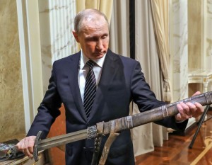
Russian President Vladimir Putin holds a sword while listening an explanations from the head of Russian First Channel Konstantin Ernst, during his meeting with the historical action film Viking’s crew, in Moscow, Russia, Friday, Dec. 30, 2016. Viking is a historical action film based on the historical document Primary Chronicle and Icelandic Kings’ sagas. (Mikhail Klimentyev, Sputnik, Kremlin Pool Photo via AP)