by Steve Dunford
The northwest part of the county took the brunt of this afternoon’s storm, as there were minor incidents of damage in the Sesser area.
This was part of a cell that weakened as 80mph winds and trees were down in Perry County, west of Pinckneyville.
School administrators at Sesser-Valier held students back for a few minutes.
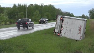
Photo by WSIL meterologist/storm chaser Tony Laubach
There was a semi that was blown over at on State Route 154 west of town. The accident was near Center road, which is close to the Perry County line.
I was in contact with Sesser Mayor, Jason Ashmore to ask if there was any damage in the city, at the time there was only one power line reported. Power was out to six homes for a brief time in the city according to Ameren’s website.
I know of one residence in the city that sustained minor roof damage.
The brunt of the damage in Southern was in Randolph County, as several media outlets have reported there was a mobile home that had a tree land on it near Chester. There were no injuries Ameren’s website reported 2,200 residents without power at 5:00 p.m.
For the rest of the night, we should experience rain, heavy at times, with rumbles of thunder.
Tomorrow should be quiet with highs in the 60’s.
There is an enhanced risk of severe weather at this time for Friday. I am really concerned about Friday afternoon.
I am more concerned about the amount of rain that we are supposed to get over the weekend than the severe thunderstorm threat. As this time, I see Sunday having a greater risk of severe weather than Saturday.
I will provide an update in the morning of the potential severe weather threat for Friday through Sunday.
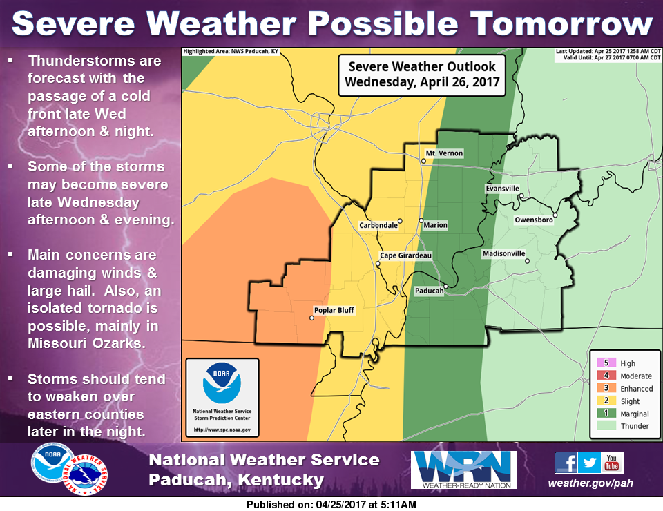 For tomorrow, mainly for the early evening hours and up until midnight there is a slight risk of Severe Weather for the western half of Southern Illinois.