by Steve Dunford
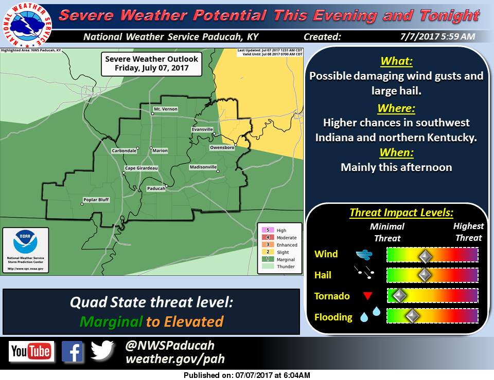 There is a marginal risk (level one of five) for severe thunderstorms for Southern Illinois, mainly for the afternoon and evening hours.
There is a line of intense, but non severe storms, that extends from the Quincy area, all the way back to Jefferson City, MO. If these stay together, the could possibly intensify in the heat of the day.
There might be some pop up storms intensify to severe levels. To me it looks like an event in which there might be a couple of warnings issued. As of now, this will not be an organized severe weather event.
If you are traveling east, the threat for severe weather is greater in the Evansville area, and for the counties along the Wabash river as well.
After this passes t0day, we should have a nice weekend with highs in the mid to upper 80’s with storm chances increasing Tuesday through Thursday.
Here is the Hazardous Weather Outlook for the National Weather Service of Paducah, KY.
This Hazardous Weather Outlook is for portions of southern
Illinois, southwest Indiana, western Kentucky, and southeast
Missouri.
.DAY ONE…Today and Tonight
Isolated to scattered thunderstorms will be possible later this
afternoon and this evening. An isolated severe storm or two
cannot be ruled out. Damaging wind gusts and hail would be the
main concerns.
.DAYS TWO THROUGH SEVEN…Saturday through Thursday
Isolated to scattered thunderstorm will be possible Tuesday
through Thursday. The main hazards with any storms would be
dangerous lightning and heavy rain. An isolated strong to severe
storm cannot be ruled out, especially during the heat of the day.
.SPOTTER INFORMATION STATEMENT…
Spotter activation cannot be ruled out today, mainly over
southwest Indiana and northwest Kentucky.


Speak Your Mind
You must be logged in to post a comment.