Below are a couple screen shots of road conditions from the website https://www.gettingaroundillinois.com/
This website is a handy tool during winter weather events.
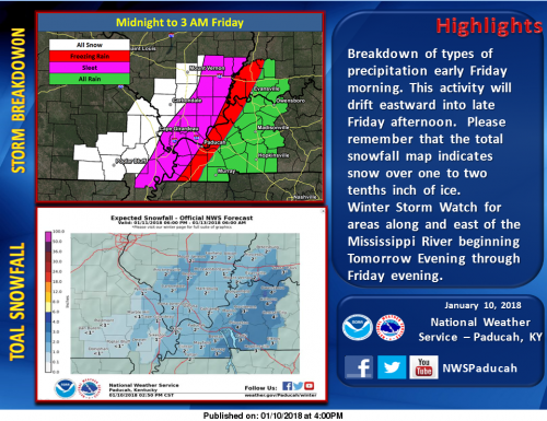
The legend to the maps are the following:
Magenta: State highways fully covered
Pink: State highways mainly covered
Blue: State highways partially covered
Below you will see the road conditions for Franklin County, the next will be all of Southern Illinois. I will update every two hours.
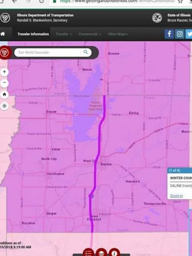
Road conditions as of 9:15 a.m.
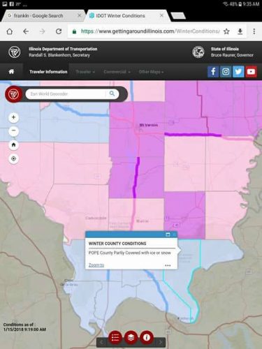
Conditions as of 9:15