by Steve Dunford
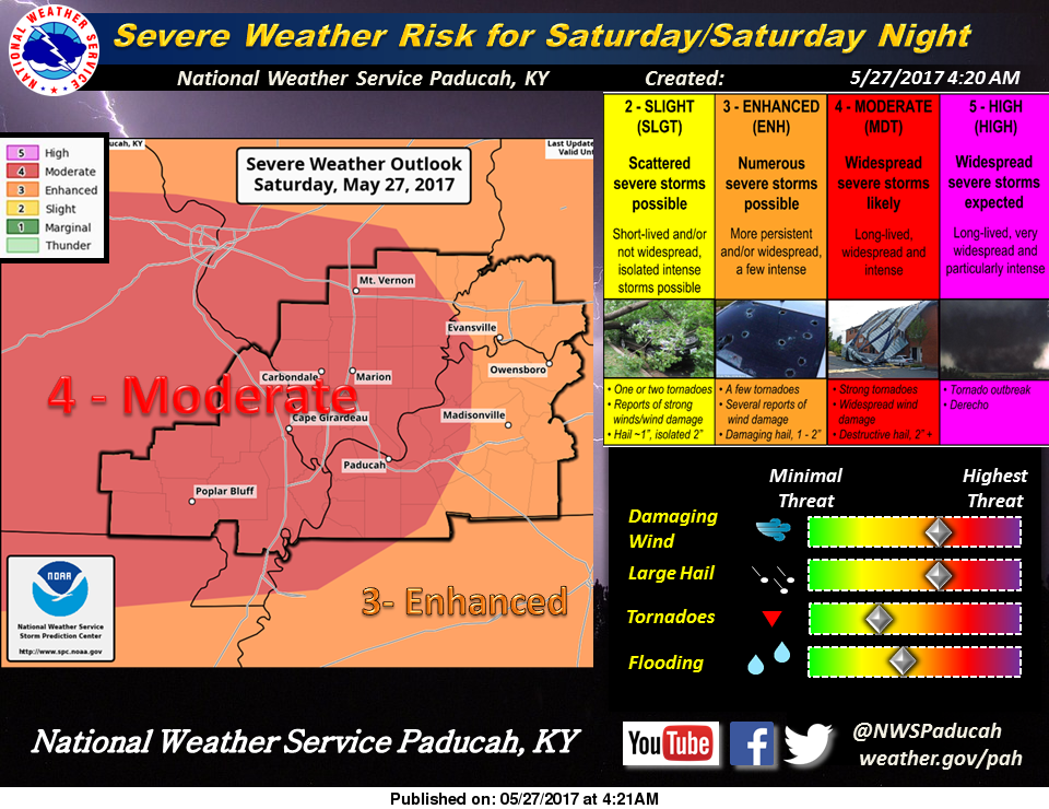
This has been forecasted for several days now. The SPC still has us in a moderate risk for severe weather. The tornado threat has lessened, but if you can see in the graphic it is still there. The main concern is damaging straight line thunderstorm winds.
The Storm Prediction center used the term hurricane force winds in a product that came out this morning. Hurricane force winds are 74 mph plus.
Please do not take this as overkill, or trying to cry wolf. This could be a system that was similar to May 8, 2009 or July 2, 1980 that caused widespread damage across the region.
This system needs to be taken very seriously and will be a fast moving system. Timing should be anytime after 4:00 p.m. I will be keeping an eye on any storm today on radar that appears to even be a rain shower. The atmosphere is so juiced any cell could turn severe quickly.
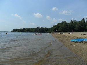
I would keep a close eye to the sky especially if you are having an outdoor event. Be prepared to take action if a county is under a warning two counties to the west or the east.
I would keep your cell phone charged, and take other precautions to have a long term power outage.
There will be several updates throughout the day on the website’s Facebook page. I will be continue to monitor the situation, and will bring updates whenever warranted. Below is the Hazardous Weather Outlook from the National Weather Service in Paduach, KY.
This Hazardous Weather Outlook is for portions of southern Illinois, southwest Indiana, western Kentucky, and southeast Missouri.
.DAY ONE…Today and Tonight Latest forecast trends indicate that an intense line of severe thunderstorms will move into the northwest part of the outlook area, namely southwest Illinois and Southeast Missouri, between 5 pm and 7pm today. This line of storms will likely produce widespread wind gusts in excess of 80 mph.
The damaging winds could last up to an hour. Depending on the intensity and duration of this line of severe storms, the line could completely move through the outlook area before midnight. In addition to the damaging wind potential, isolated severe storms may develop ahead of this line later today. These storms would have the potential for large hail, damaging winds, as well as a tornado.
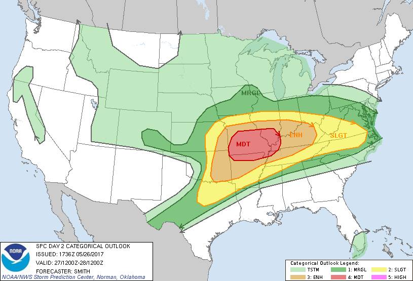
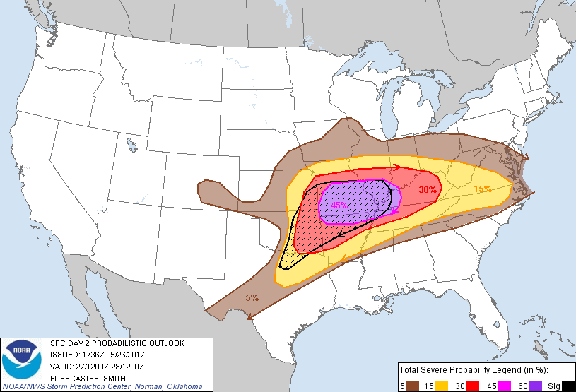
A moderate risk remains in place for most of the outlook area, except parts of Southwest Indiana and the Pennyrile region of West Kentucky, which remain in an enhanced risk of severe thunderstorms. At this time, the greatest risk for widespread severe thunderstorms is later this afternoon and this evening. A few storms may still be likely over parts of Southeast Missouri and West Kentucky during the morning hours. Every form of severe weather is possible, including damaging winds, large hail, and tornadoes. Heavy rainfall and deadly lightning will also be storm hazards.
.DAYS TWO THROUGH SEVEN…Sunday through Friday A slight risk of severe thunderstorms is forecast Sunday, especially during the afternoon and early evening. Damaging winds and hail are the primary severe weather hazards, with locally heavy rain and deadly lightning also storm hazards. Thunderstorms are also forecast Tuesday afternoon, and Wednesday through Friday.
.SPOTTER INFORMATION STATEMENT… Spotter activation is expected today and tonight.
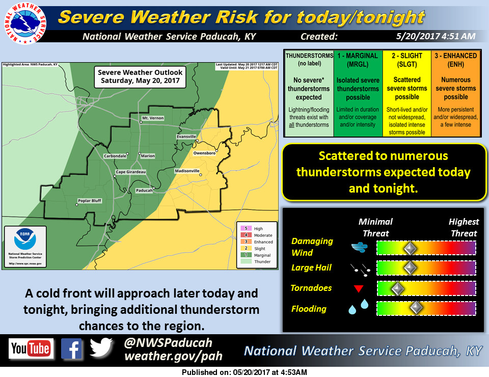 The Storm Prediction Center has downgraded the threat for severe thunderstorms from slight (level 2) to marginal (level 1) for today.
 EVANSVILLE, IL (West Frankfort Gazette – Click to read the full story on the link above. Here is an excerpt below)

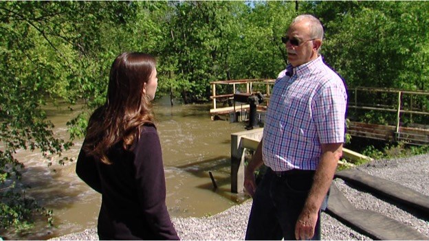 WEST FRANKFORT, IL (Roni Leforge – WSIL TV. Please click to read the full story and watch the accompanying video. Here is an excerpt) City leaders dispute claims they didn’t do enough to ease flooding that caused people to leave their homes. Several homes had more than six inches of standing water inside over the weekend, which led some residents to believe the city’s pumps may have not been working properly. But News 3 spoke with the mayor, who says the pumps were working just fine. The system just couldn’t get the water out of town quickly enough. Michele Odle spent Tuesday morning unpacking her home. “I left pots and pans and stuff like that in there, but all my big furniture and stuff was all in a U-Haul,” said Odle. Within hours on Saturday morning, her yard had become a lake. She and her husband decided to get the important things out, so they wouldn’t be destroyed by flood waters.