by Steve Dunford
The unseasonably pleasant weather pattern will be turning into late June and early July type weather over the next several days.
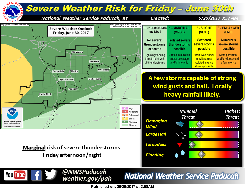
I usually do not share when there is a marginal risk of severe weather (Level 1 of 5) until that day, but since we are approaching a holiday weekend I will share it in advance. There is a marginal risk for Friday into Saturday for Southern Illinois.
What I am seeing in the charts is a risk of pop up thunderstorms on Friday afternoon for the region, and more widely scattered thunderstorms in the evening and overnight hours into Saturday morning. The thunderstorm chances are slim (40% on Friday and 30% on Saturday) but it is something to keep an eye on if you are planning any outdoor activities. As of now, it would not be a plan altering event.
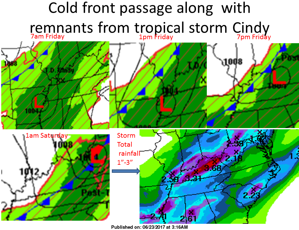
Saturday night into Sunday looks dry, with rain chances coming back in on Monday and on the fourth.
Here is the Hazardous Weather Outlook form the National Weather Service in Paducah, KY .
DAY ONE…Today and Tonight A few thunderstorms are possible over parts of western Kentucky and southeast Missouri this afternoon, mainly along the Arkansas and Tennessee borders. Dangerous lightning will be the main hazard with any storms. .
DAYS TWO THROUGH SEVEN…Friday through Wednesday There is a chance of thunderstorms Friday through Saturday evening. An organized complex of thunderstorms is possible Friday afternoon into the night time hours. Locally damaging wind gusts and hail cannot be ruled out, along with heavy rainfall. There is a chance of thunderstorms Monday through Wednesday. There may be isolated strong storms, along with locally heavy rainfall.

 by Steve Dunford
  Ronald Dean Eubanks, age 57, formerly of Benton, passed away Sunday, June 11, 2017 in Panama City, FL from injuries sustained in a motorcycle accident.