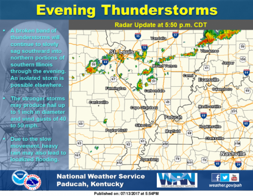
Radar Update at 5:50 PM: A broken band of thunderstorms will continue to slowly sag southward into northern portions of southern Illinois through the evening. An isolated storm is possible elsewhere. The stronger storms may produce hail up to 1 inch in diameter and wind gusts of 40 to 50 mph. Due to the slow movement, heavy rain may lead to localized flooding as well.
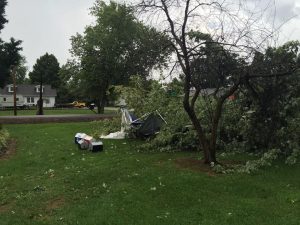 The brunt of the damage was in the Sesser Area. I had several pictures of wind damage. The picture is of d downed tree in Jim and Carleen Roberts yard on the north side of the city. It also shows pieces of their smashed produce stand . Hopefully, I will be writing a story about their endeavors some time next week.
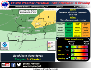 There is a marginal risk (level one of five) for severe weather for this afternoon into the overnight hours for Franklin County and most of Southern Illinois. As you can see from the graphic to the left, There are a few counties in Southern Illinois that are on the edge of a slight risk (level 2 of severe weather).