http://www.wsiltv.com/story/36059516/jobs-still-available-as-workers-prep-for-du-quoin-state-fair
DU QUOIN, IL – (Hannah Gebresilassie, WSIL-TV. Please click on the link above for the full story. Here is an excerpt below.)
Preparations are underway for the Du Quoin State Fair, with the big event just three weeks away.
Organizers said they’ve been planning for the fair for months. Thursday, orientation kicked off for several workers who will work the fair from August 25th through September 4th.
The Illinois Department of Agriculture is still accepting applications for the fair, but you must be 16 or older to qualify.
You can visit here to submit an application by clicking on “summer employment” at the bottom of the page.
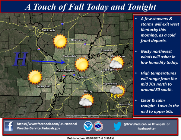 Hazardous Weather Outlook