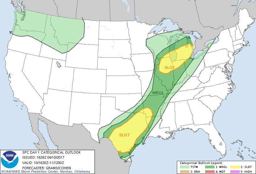
 There is a marginal risk for severe weather for the late evening, into the overnight hours for all of Southern Illinois.
There is the possibility for a pop up scattered thunderstorm this afternoon. This evening, the main activity will be in front of an approaching cold front.
Here is the Hazzardous Weather Outlook from the National Weather Service in Paducah, KY
.DAY ONE…Today and Tonight Isolated to scattered thunderstorms are expected to develop over the region this afternoon and tonight. A stray severe storm or two cannot be ruled out from southeast Missouri through southern Illinois and into southwest Indiana late this afternoon and this evening. Large hail and damaging winds will be possible, to go along with the more general lightning and locally heavy rainfall concerns. Strong south to southwest winds will gust 25 to 35 mph outside of thunderstorms today and this evening.
.DAYS TWO THROUGH SEVEN…Tuesday through Sunday A chance of thunderstorms is forecast mainly for the southeast half of the region Tuesday. Locally heavy rainfall will be a concern, especially over west Kentucky. A chance of thunderstorms is forecast off and on across the region from Thursday through Sunday. At this time, the chance of organized severe thunderstorms is low. Lightning and locally heavy rainfall will be the primary concerns through this period.
We will keep you informed of any updates.


Speak Your Mind
You must be logged in to post a comment.