Benton, West Frankfort, Illinois News | Franklin County News
Newspaper covering Franklin County, Illinois
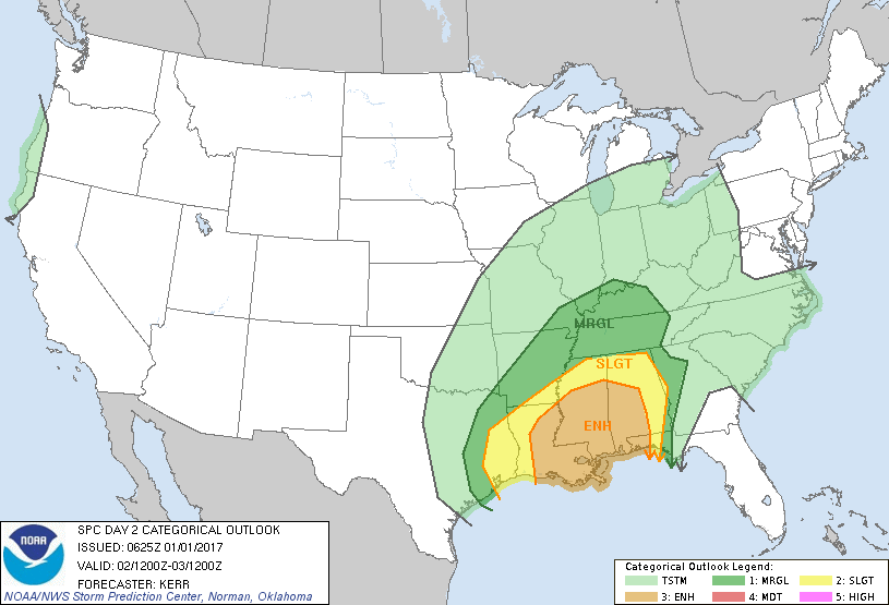
So far the anticipated snow in the weather charts earlier this weekend is forecasted to be flurries on Thursday. Cloudy and a high of 46 today before the rain settles in and a chance of thunderstorms. We are on the border for a marginal risk of severe weather on Monday. There is a graphic from the storm prediction center attached for tomorrow. This is what the hazardous weather outlook form the National Weather Service says…A CHANCE OF THUNDERSTORMS IS FORECAST…MAINLY MONDAY INTO MONDAY EVENING. AN ISOLATED STRONG OR SEVERE STORM CANNOT BE RULED OUT. DAMAGING WIND GUSTS AND LOCALLY HEAVY RAIN WILL BE THE PRIMARY THUNDERSTORM HAZARDS..Please click on the link for the seven day forecast from the NWS in Paducah for Franklin County
You must be logged in to post a comment.
December 29, 2024
Columns Archives...


Speak Your Mind
You must be logged in to post a comment.