by Steve Dunford
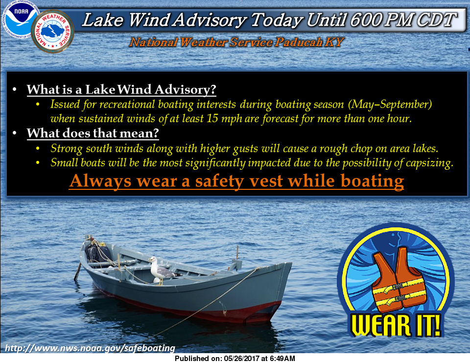
Before we talk about tomorrow, we are going to take care of the business for today. The National Weather Service has issued a Lake Wind Advisory from 10 a.m. this morning until 6 p.m. tonight. Below is the text from the national weather service in Paducah KY:
 …LAKE WIND ADVISORY IN EFFECT FROM 10 AM THIS MORNING TO 6 PM CDT THIS EVENING…
The National Weather Service in Paducah has issued a Lake Wind Advisory, which is in effect from 10 AM this morning to 6 PM CDT this evening. *
TIMING…From late morning through the afternoon. *
WINDS…South winds will be sustained from 15 to 20 mph with gusts 20 to 30 mph. *
IMPACTS…Winds are expected to be strong enough to cause problems for boaters on area lakes. Small boats will be the most significantly impacted. Boaters on Kentucky Lake, Lake Barkley, and Rend Lake will be significantly impacted due to their extensive south fetches.
PRECAUTIONARY/PREPAREDNESS ACTIONS… A Lake Wind Advisory indicates that winds will cause rough chop on area lakes. Small boats will be especially prone to capsizing.
Spending several holiday weekends on Rend Lake, boat traffic will increase today with the upcoming holiday weekend. The lake is usually choppy with the additional boats on the water.
With south winds gusting up to 30 mph, make sure your craft could handle the choppy waters. Caution needs to be taken crossing the main body, especially south of route 154.
Randolph, Perry, Franklin, Hamilton, and White counties are on the southern edge of a marginal risk (level one of five) for severe weather today. There is a very slight chance of large hail and damaging thunderstorm winds. The storm prediction center has the tornado threat near zero today.
There is only a 20% chance of showers and thunderstorms today and tonight, but for any that pop up they could turn severe pretty quick. I would not alter any outdoor plans for today, I would just keep my eye to the sky.
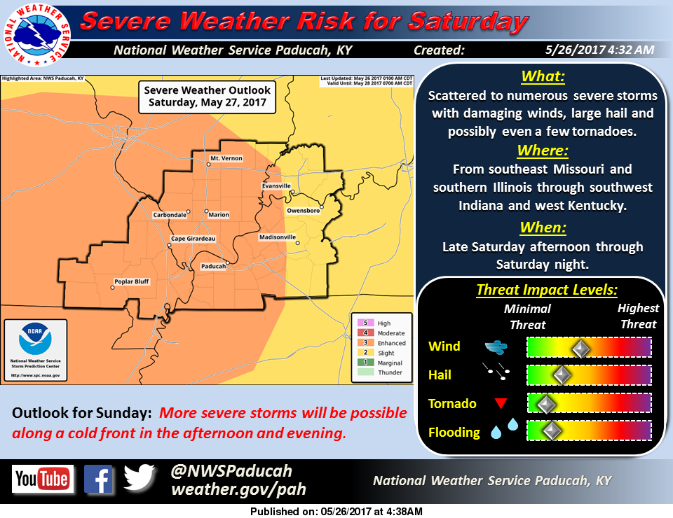
We are still under an enhanced (level three of five) risk of severe weather for tomorrow. The main threat will be in the late evening hours. The atmosphere will be juiced tomorrow, with it hot, humid, and highs in the mid 80’s.
As you can see in the graphic above, straight line winds is the main threat. The tornado threat is still minimal. The risk for tornadic activity tomorrow would be a pop up storm in front of the main system. A storm could go severe in a hurry and an outside chance a supercell could form.
Several are following a Facebook page, that has Franklin and surrounding counties in the bulls-eye for violent tornadoes. If this was the case, the SPC would place us under at least a moderate or a high risk of severe weather. This system is to be very concerned about, but not to panic about.
I will be monitoring the situation tomorrow. I now have NWS-chat access. I will be able to see what the meteorologists in all three of the TV news outlets are saying, as well as local emergency management officials. I count it an honor to be entrusted with this, and will be able to provide better severe weather coverage.
Below is the hazardous weather outlook issued by the NWS in Paudcah.
.DAY ONE…Today and Tonight A few thunderstorms will spread eastward into southeast Missouri early this morning. They should dissipate by 10 AM before reaching the Mississippi River. Lightning will be the primary concern. Small chances of thunderstorms are forecast tonight, mainly along the Interstate 64 corridor of southern Illinois and southwest Indiana. A few severe storms with large hail and damaging winds will be possible if storms can develop.
.DAYS TWO THROUGH SEVEN…Saturday through Thursday Thunderstorms are forecast throughout the region Saturday through Sunday evening. Any storms that develop through this period may become severe, but the greatest threats will be late Saturday into Saturday night, and possibly again along the cold front Sunday afternoon and evening.
The latest guidance suggests that one or more thunderstorm complexes may move through the region with primarily a damaging wind threat. Any individual storms would pose a threat of very large hail to go along with damaging winds and possibly a few tornadoes.
In addition, heavy rainfall may lead to flash flooding where multiple storms train over the same locations. Small chances of afternoon and evening thunderstorms are forecast for all or a portion of the region Tuesday and Wednesday. Better chances of thunderstorms are forecast throughout the area Thursday and Thursday night. Locally heavy rainfall and lightning will be the primary concerns.
.


Speak Your Mind
You must be logged in to post a comment.