WPSD TV- Paducah KY graphic
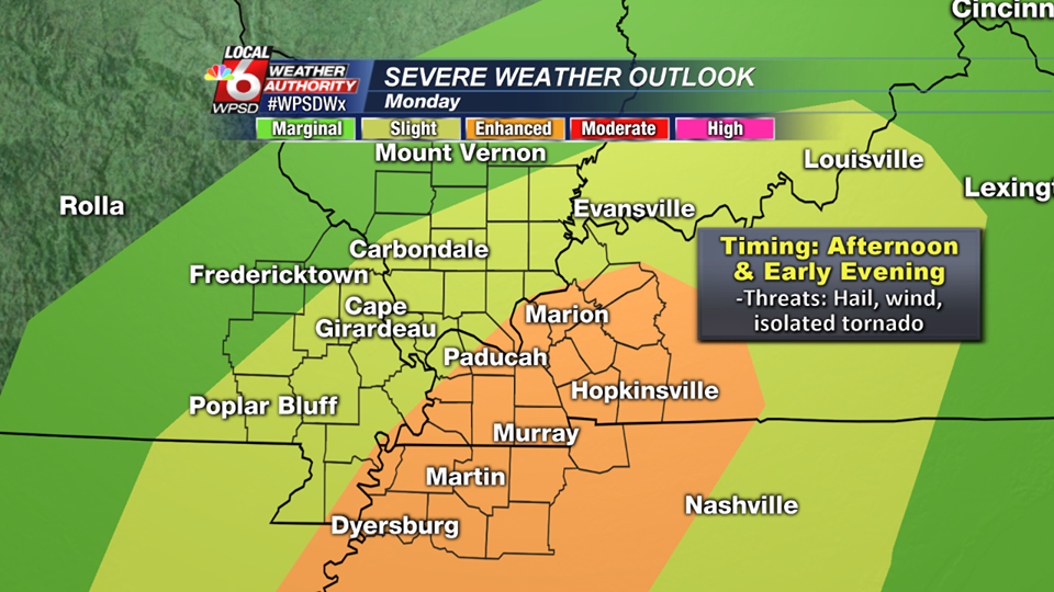
As you can see in the graphic above, Franklin County is split between the area of having a slight to a marginal risk for severe weather.
The main threat for today’s storms is damaging thunderstorm winds. There might be some small hail. The tornado threat at this time is minimal.
The main ingredient today will be instability. We have a line of storms that are on top of us now. These will be non severe with some rumbles of thunder. If the sun comes out after these and juices the atmosphere, the severe threat today will be much greater.
Here is the hazardous weather outlook from the National Weather Service in Paducah, KY
.DAY ONE…Today and Tonight Thunderstorms are possible over all or part of the outlook area today and tonight. A few storms may become severe mainly this afternoon and evening with damaging winds and large hail being the primary hazards. A tornado or two is not out of the question. Otherwise locally heavy downpours and lightning will be the primary hazards.
.DAYS TWO THROUGH SEVEN…Tuesday through Sunday Thunderstorms are possible over all or part of the outlook area Wednesday night, Thursday, and Thursday night. Widespread severe weather is not expected at this time. Locally heavy downpours and lightning will be the primary hazards.
From early this afternoon on, I will be able to keep you informed. The Facebook page will be the best way to receive watches and warnings. I will try to put them on the website as well if time allows. -sd


Speak Your Mind
You must be logged in to post a comment.