Though there will not be any heat advisories or warnings today, conditions will still be warm and humid, with highs in the upper 80s to lower 90s. Tuesday will be similar to today, but with a slightly greater coverage of afternoon and evening showers and thunderstorms. (NWS, Paducah)
The Storm Prediction Center in Norman, OK has placed the counties from Route 13 North in a marginal risk for severe weather.
Hazardous Weather Outlook
National Weather Service Paducah KY
This Hazardous Weather Outlook is for portions of southern
Illinois, southwestern Indiana, western Kentucky, and southeastern
Missouri.
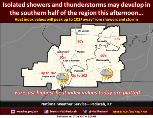
.DAY ONE…Today and Tonight
Isolated thunderstorms may develop this afternoon and evening in
the southern half of the region. A stronger storm or two might
produce locally strong to marginally severe wind gusts. Heat
indices of around 100 are forecast this afternoon for parts of
southeastern Missouri and the Purchase area of Kentucky.
.DAYS TWO THROUGH SEVEN…Tuesday through Sunday
Though heat indices may be around 100 in southern parts of the
region Tuesday and Thursday afternoons, the entire region may
have heat indices ranging from 100 to 105 Wednesday afternoon.
There is a chance of thunderstorms Tuesday, mainly for the
southern counties, and for the entire region Wednesday through
Friday. The storms may produce locally heavy rain and gusty winds.
.SPOTTER INFORMATION STATEMENT…
Spotter activation is not anticipated.
Detailed Forecast
weather.gov |


Speak Your Mind
You must be logged in to post a comment.