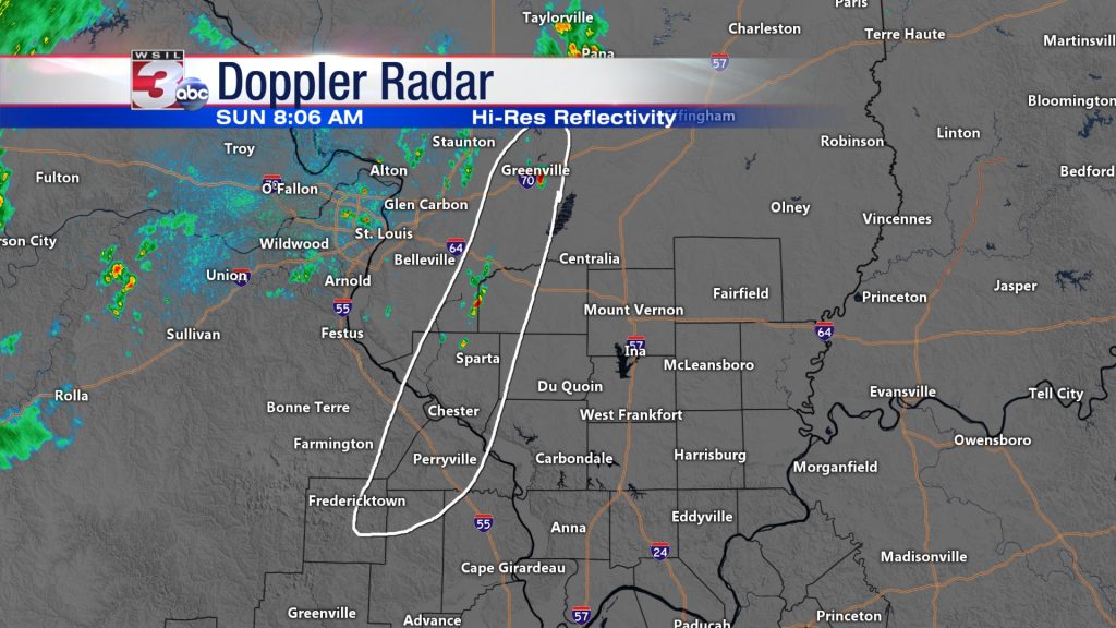
Watching this area for further shower and storm development through the late morning, likely being aided by outflow from storms across central Missouri. Storms will move east and north, affecting areas along I-64 near Washington and northern Perry County over the next hour. Not expecting any severe weather from these, but some heavy rain and gusty winds are possible in these. Storms will be possible area-wide through the day today with increasing chances Monday through Wednesday. (WSIL-TV’ social media post)
I usually use the graphic from the National Weather Service, but this graphic from Channel 3 popped up on Facebook. We could get some showers and thunderstorms in Franklin County. It might be handy to take an umbrella to church with you.
Hazardous Weather Outlook
.DAY ONE…Today and Tonight
A chance of thunderstorms is forecast across mainly southeast
Missouri and southern Illinois this afternoon into tonight.
Storms will be capable of producing lightning and heavy rain.
.DAYS TWO THROUGH SEVEN…Monday through Saturday
A chance of thunderstorms is forecast for much of the region
Monday through Wednesday. Coverage should be scattered with a
greater concentration during the heat of the day.
Isolated storms remain possible over portions of the area
Thursday through Saturday. Storms will be capable of producing
lightning and heavy rain.
.SPOTTER INFORMATION STATEMENT…
Spotter activation is not anticipated at this time.
Seven Day Forecast
Today
A 20 percent chance of showers and thunderstorms after 1pm. Partly sunny, with a high near 88. South southwest wind 3 to 6 mph.
Tonight
A 30 percent chance of showers and thunderstorms, mainly before 11pm. Mostly cloudy, with a low around 68. Calm wind.
Monday
A 50 percent chance of showers and thunderstorms. Mostly cloudy, with a high near 84. Calm wind becoming south southwest around 6 mph in the afternoon.
Monday Night
A 50 percent chance of showers and thunderstorms. Mostly cloudy, with a low around 67. Light south southeast wind.
Tuesday
A 30 percent chance of showers and thunderstorms. Partly sunny, with a high near 87. Calm wind becoming south southwest around 6 mph in the morning.
Tuesday Night
A 20 percent chance of showers and thunderstorms after 1am. Partly cloudy, with a low around 68. South wind 3 to 5 mph.
Wednesday
A 20 percent chance of showers and thunderstorms before 1pm. Mostly sunny, with a high near 87. South wind 5 to 8 mph.
Wednesday Night
Partly cloudy, with a low around 69. South wind around 6 mph.
Thursday
Mostly sunny, with a high near 88. South wind 5 to 7 mph.
Thursday Night
Partly cloudy, with a low around 68. South southeast wind 3 to 5 mph.
Friday
A slight chance of showers and thunderstorms. Mostly sunny, with a high near 87. South southeast wind 3 to 7 mph.
Friday Night
Mostly clear, with a low around 67. South southeast wind 3 to 5 mph.
Saturday
A slight chance of showers and thunderstorms. Mostly sunny, with a high near 87. South wind 3 to 6 mph.


Speak Your Mind
You must be logged in to post a comment.