National Weather Service- Paducah KY
http://www.weather.gov/pah/2017May27_SevereWeather
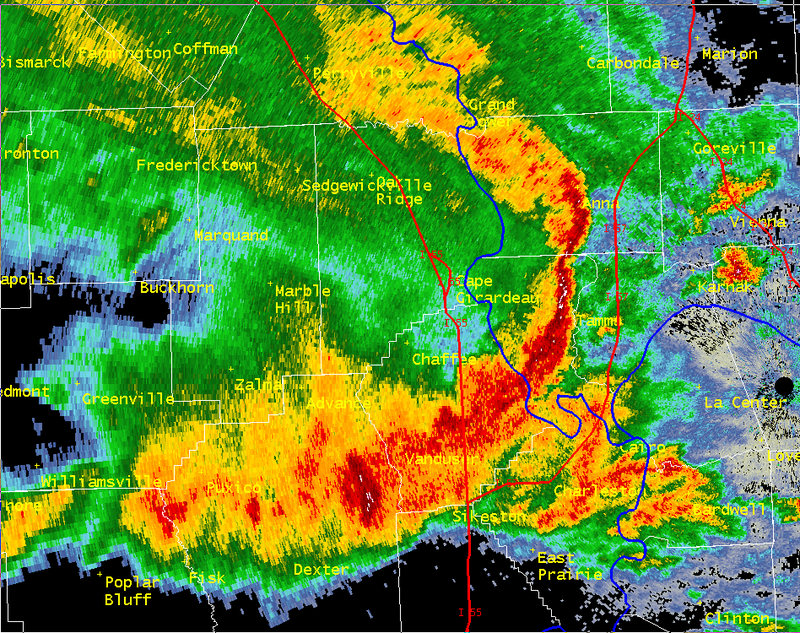
Radar Image as the storm crossed the river into Alexander and Union counties. (National Weather Service – Paducah KY)
NOTE: Here in Franklin County we were spared for the most part, as we had a cell bearing down on us from the west that produced close to 110 mph winds in Central MO.
The most intense storm in the county was on the east side of the county in the Thompsonville-Akin area around 2:00 p.m.
The cell that prompted the Storm Prediction Center to use the term Hurricane Force Winds dropped to the southeast, going through Southeast Missori, the Southern Seven counties of Southern Illinois and Western Kentucky.
The above link will take you to an interactive page of the National Weather Service. Here is an overview of the event below from the NWS page. -sd
Multiple rounds of severe thunderstorms impacted the Middle Mississippi Valley on the 1st day of the Memorial Day holiday weekend. Many observations of large hail and damaging winds were reported throughout the region, including wind speeds upwards of 70 to 80 mph and some hailstones measuring golfball sized and slightly higher.
There were multiple bowing segments that impacted the region with damaging winds the main impact from those. Each one seemed to develop further south than the one prior. Multiple individual cells and clusters also developed, especially early on in the event.
The brunt of the storms focused across southeast Missouri into much of southern Illinois and western Kentucky. Multiple rounds of storms over the same locations also resulted in some flooding issues requiring the issuance of a few flash flood warnings as well.
Rainfall totals of 1.5 to 3+ inches were observed from Carter County Missouri east into southern Scott County and into Carlisle and northern Graves Counties in Kentucky. The lowest amounts were up along the I-64 corridor and across the Evansville Tri-State area where only isolated heavier amounts were reported.


Speak Your Mind
You must be logged in to post a comment.