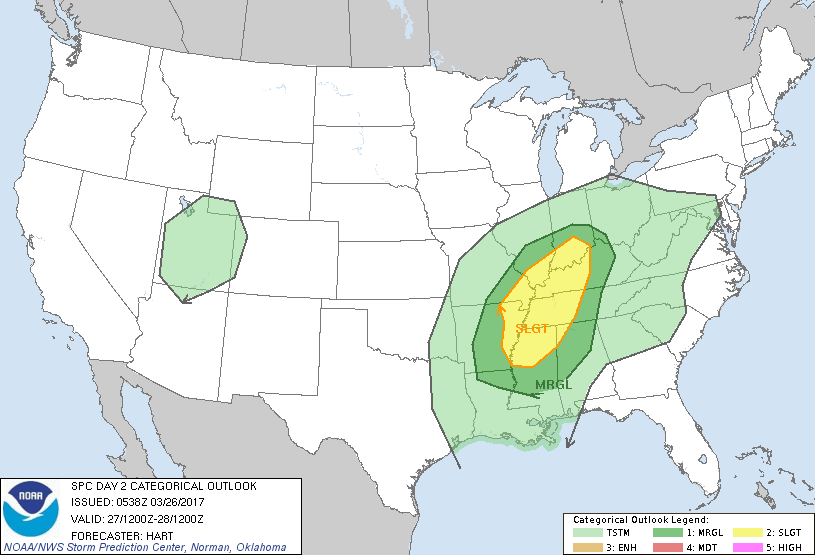
 The Storm Prediction center in Norman OK has Southern Illinois placed under a slight risk of severe weather for tomorrow. The slight risk boundary runs from points south and east from Chester to Mt. Carmel.
The main threat, for tomorrow afternoon and evening, will be large hail and damaging winds. Here is the latest hazardous weather outlook from the National Weather Service in Paducah KY.
.DAY ONE…Today and Tonight Thunderstorms are possible over all or part of the outlook area late tonight. Locally heavy downpours and lightning will be the primary hazards.
.DAYS TWO THROUGH SEVEN…Monday through Saturday Thunderstorms are possible over all or part of the outlook area Monday through Monday evening. A few storms may become severe during the afternoon and evening hours with damaging winds and large hail being the primary hazards. Otherwise Locally heavy downpours and lightning will be the primary hazards. Thunderstorms are possible over all or part of the outlook area from Wednesday night through Thursday. Locally heavy downpours and lightning will be the primary hazards.
Please follow the Facebook page throughout the day for updates on the potential for tomorrow.


Speak Your Mind
You must be logged in to post a comment.