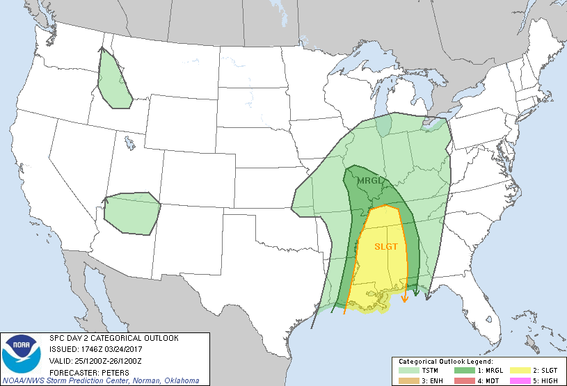
There is a marginal risk for severe weather tomorrow for Franklin County and the rest of Southern Illinois.
The wind shear in the atmosphere will be high. The greatest threat will be for damaging thunderstorm winds. The tornado and hail threat will be minimal.
Here is the latest Hazzardous weather outlook from the National Weather Service in Paducah KY.
.DAY ONE…Today and Tonight There is a chance of thunderstorms late today and tonight. A few strong to severe storms cannot be ruled out over southeast Missouri tonight. The main hazards will be locally heavy rain and dangerous lightning. A few isolated damaging wind gusts are possible over southeast Missouri. Winds will be gusty from the south this afternoon and evening. Gusts from 30 to 40 mph are possible across our region.
.DAYS TWO THROUGH SEVEN…Saturday through Thursday Thunderstorms are likely on Saturday into Saturday evening. Isolated severe storms cannot be ruled out on Saturday. Winds will remain gusty from the south, possibly gusting over 30 mph once again on Saturday. There will be a chance of thunderstorms for much of next week, except for Tuesday and Tuesday night. The main hazards with these storms will be locally heavy rain and dangerous lightning.
We will keep you informed at Franklin County News of the developing situation.


Speak Your Mind
You must be logged in to post a comment.